This Advisory is No Longer in Effect (21st January 2026)
This advisory is no longer in effect. However, significant flood risks persist across King County. While the Cedar River at Renton is currently holding steady below flood stage, minor flooding continues along the Green River near Auburn. Residents in historically flood-prone areas—including Renton, Kent, Auburn, and Tukwila—should remain vigilant. River levels can change rapidly due to dam operations and additional rainfall. For the latest official conditions, continue to monitor the National Weather Service and King County Flood Warning Center. Remember: never attempt to drive through flooded roadways.
Previous: Flood Update: Cedar River at Renton, King County, Washington
6:15 AM PST on Friday, 19th December 2025
A flood warning remains in effect due to a dam floodgate release, though no flooding is currently forecast. The river stage was recorded at 12.9 feet at 6:15 AM PST Friday, with flood stage at 13.0 feet. It dropped to 12.8 feet early this morning but remains very close to flood stage.
Forecast indicates the river will stay steady at around 12.8 feet below flood stage; however, the warning is maintained as a precaution due to potential rapid changes from dam operations.
Location
Cedar River at Renton, King County, Washington, United States (primarily affecting areas like Renton and upstream in the Dorre Don area near Maple Valley).
Key Dates and Timestamps
- River stage observation: 6:15 AM PST on Friday (exact date not specified in alert, but context indicates the recent Friday prior to the update).
- River fell below flood stage: Early this morning (relative to the alert issuance).
- Next NWS statement: Expected this afternoon at 3:00 PM PST.
- Warning in effect: Until late this afternoon.
- Alert updated: 5 hours ago (as of current query on December 20, 2025).
Impacts
- At 11.3 feet: Local bank overflow possible, causing standing water (especially upstream in the Dorre Don area).
- Current levels: No active overflow, but monitoring continues.
Recommended Actions
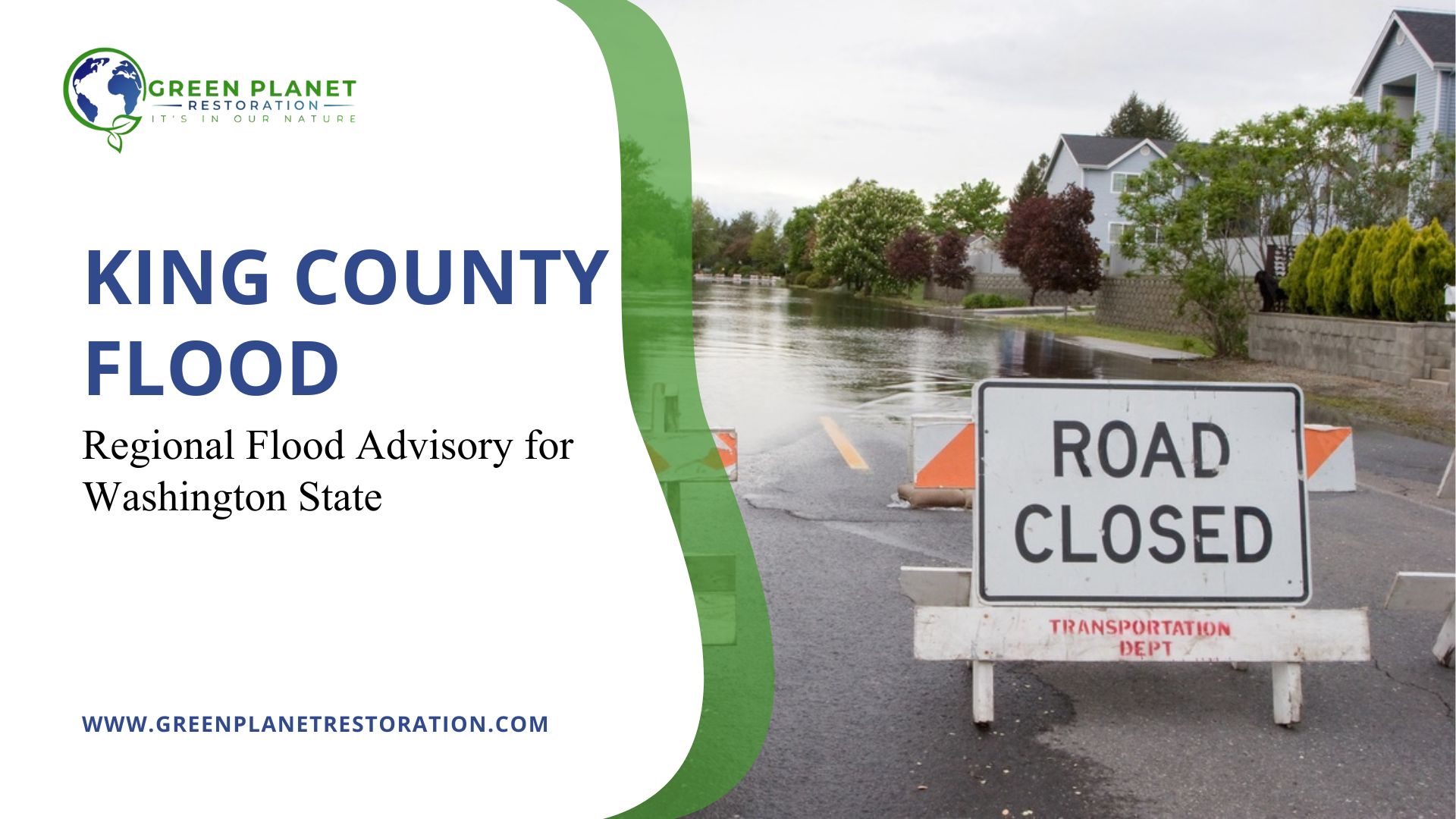
- Turn around, don’t drown: Avoid driving through flooded roads or around barricades (most flood deaths occur in vehicles).
- Additional resources: Visit www.weather.gov/safety/flood for more details.
- Source: National Weather Service (weather.gov). For real-time updates, check King County flood resources at flood.kingcounty.gov or road closures at gismaps.kingcounty.gov.
King County Focus | Previous Advisory Time: 10:45 PM PST, Monday, December 15
King County flood advisory reflects conditions reported by the National Weather Service as of 10:45 PM PST on December 15, with the next official update scheduled for 8:00 AM PST. A King County flood warning remains active as river levels across southern King County continue to exceed flood thresholds.
Current Flood Conditions in King County
Washington Flooding Today remains concentrated along the Green River near Auburn, with secondary impacts affecting communities downstream. Minor flooding is occurring and is expected to persist until further notice. King County flood (Observed and forecasted) conditions include:
- River flow measured 9,730 cubic feet per second (cfs) at 10:45 PM PST.
- Flood stage is defined at 9,000 cfs, classified as a Phase 3 flood in the King County flood system.
- Maximum flow reached 10,200 cfs in the previous 24-hour period.
- Forecast models show a gradual rise toward 10,300 cfs by Wednesday afternoon.
At these levels, water spreads into low-lying areas of the middle Green River Valley. Sections of SE Green Valley Road have experienced overflow, with backwater flooding reported near Auburn, Kent, and the lower Mill Creek basin.
Dam Operations and River Management
Ongoing dam operations across the region are contributing to elevated river flows. These controlled releases are intended to reduce upstream flood risk by managing reservoir capacity during sustained rainfall. While releases are planned and monitored, they keep downstream rivers flowing above seasonal norms, increasing pressure on levee systems and flood-prone corridors. Residents near regulated rivers should expect water levels to remain high even during breaks in rainfall.
Levees and Southern King County Risk Areas
Recent reporting from Reuters, USA Today, FOX 13 Seattle, and the Auburn Reporter highlights areas of concern along the Green River levee, including sections associated with the Desimone Levee. While impacts remain localized, these systems continue to shape southern King County floods today, particularly near Kent, Renton, and Tukwila.
The Green River levee map, the southern King County Flood Map, and the Washington flood warning map provide the clearest view of neighborhood-level exposure. The official King County flood map remains the primary reference for evacuation planning.
Safety Guidance for At-Risk Residents
Flood risk varies by household. Residents are advised to avoid low-lying roads and waterways. Conditions south of Seattle remain volatile and subject to rapid change. Extra caution is advised for:
- Older adults and those with mobility limitations
- Mobile home residents, especially near rivers or drainage channels
- Pet owners, who should plan safe transport and shelter options in advance
Six inches of fast-moving water can knock a person off their feet, while two feet can carry a vehicle. Never attempt to drive through flooded roads. Most flood fatalities occur inside cars.
What to Do Next
Monitor alerts from the National Weather Service and King County officials. Review King County flood evacuation routes before access roads close. Avoid riverbanks, trails, and low crossings near the Green and White Rivers. Check official updates again at 8:00 AM PST, or sooner if conditions change.
- View the King County Flood Map for current impact zones.
- Monitor updates on the Flood Warning Washington Map.
- Track Washington Flooding Today and Potential Flash Flood Warnings
Flood conditions across King County remain fluid. Staying informed, acting early, and following official guidance reduce risk as river levels continue to rise. In case of house flooding, call Green Planet Restoration of Seattle for emergency water extraction and damage restoration services in Washington.
Our Emergency Contact:
- Official: +1 (800) 719-4808
- Seattle: (564) 676-3806
- Email: info@gprla.com
_________________
References
Auburn Reporter. (2025, December 15). Green River levee breach impacts small areas of Kent, Renton, and Tukwila.
https://www.auburn-reporter.com/news/green-river-levee-breach-impacts-small-areas-of-kent-renton-and-tukwila/
Fox 13 Seattle. (2025, December 15). Flash flood warning issued for King County as rivers rise.
https://www.fox13seattle.com/news/flash-flood-warning-king-county
National Weather Service. (2025, December 15). Flood warning remains in effect for the Green River near Auburn and White River at R Street Bridge.
https://www.weather.gov/safety/flood
Reuters. (2025, December 15). Flash flood warnings follow levee breach in Washington state.
https://www.reuters.com/sustainability/climate-energy/flash-flood-warnings-follow-levee-breach-washington-state-2025-12-15/
USA Today. (2025, December 15). Levee failure prompts flooding in Seattle, Tukwila, and surrounding areas.
https://www.usatoday.com/story/news/nation/2025/12/15/levee-failure-flooding-seattle-tukwila-washington/87782919007/